What is contour survey?
In construction parlance, a contour is nothing but the outline of a mass of land. Contouring or contour survey is the process in which the height or elevation of the different points of the land are identified and then fixed in the same horizontal position.
What is contour survey?
In construction parlance, a contour is nothing but the outline of a mass of land. Contouring or contour survey is the process in which the height or elevation of the different points of the land are identified and then fixed in the same horizontal position.

Why is contour survey important?
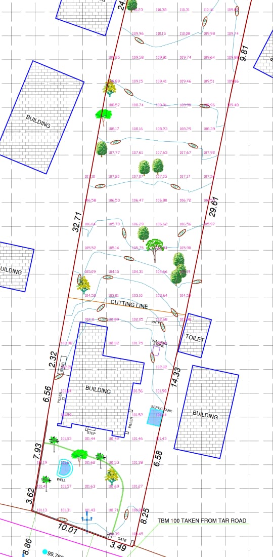
A contour survey provides valuable information regarding the characteristics of the land proposed for construction. It is primarily done to check if the land to be used for construction is at the same level. It also identifies the different objects in the property like trees, water bodies etc.
The outcome of the contour survey is a contour map. Based on the contour map, the design team can take decisions on whether to level or widen the land or not. It also helps the architect to perform the spatial planning in the property where the house is being constructed. This will help to identify how much site work is required before the construction can start.
How is contour survey done?
Contour survey is done by a professional surveyor who is qualified to do so. Accuracy of the contour map is key. This is very important as several decisions that involve spending of money need to be made based on the contour map.
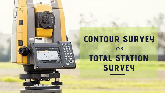
Total stations are used for performing professional contour surveys. The main components of a total station survey are
- Total station that consists of a distance measuring instrument and an angle measuring instrument known as the theodolite, along with a microprocessor. The total station is held in a tripod
- Electronic notebook that is the brain of the total station. It is used to record the data and perform calculations, thereby reducing human interventions.
- Prism and pole – Used as reflectors for the electronically measured signal.
- Battery

Advantages of a total station survey
- Saves time and human interventions as most of the manipulations and calculations are done in the instrument itself.
- Easy to setup
- Multiple surveys can be done at the same setup location.
- Measurements are more accurate compared to conventional surveying techniques.
- The data can be saved and transferred to a hard disk easily.
- It can also be used for digitizing old maps.
- Minimal errors
Disadvantages of a total station survey
- The equipment is sophisticated and therefore requires trained personnel to operate.
- The equipment is expensive compared to conventional surveying techniques.
For more queries on professional house construction or for getting the contour survey of your property done, call us now at +91 8138 800 800


